One of my librarian friends back in the U.S. sent me a link to a project by the University of Chicago library: Late 19th- and Early 20th-Century Latin American Cities. Included are digital copies of 2 maps of Buenos Aires held by the University of Chicago Library’s Map Collection.
Like all good online maps these days, these feature that nice zoom-and-pan tool.
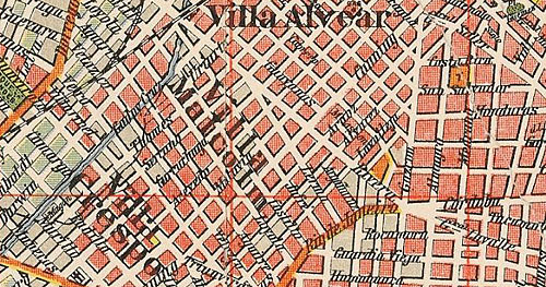
This map shows two barrios, Villa Alvear and Villa Malcolm, that have since been re-named as parts of Palermo. Personally, I like the older names.
Since tango is not a part of my Buenos Aires experience (and I don’t really wander around this part of the city too much), I didn’t realize that there is a tango joint called Villa Malcom. And here’s some video of tango dancing at Villa Malcom.
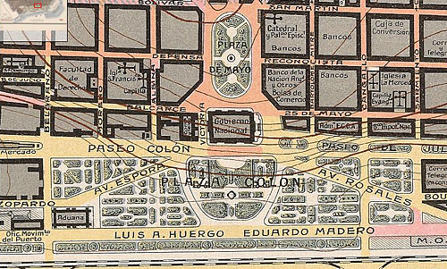
Colorful isn’t it? Plaza Colón looked very nice back in 1916.
The map is quite extensive and covers the entire city, not just the downtown. Note the topographic contour lines showing the elevation.


August 28th, 2011 at 8:24 pm
Un gran hallazgo poder ver como era mi ciudad en 1912. Un agradecimiento profundo por compartir estos planos.